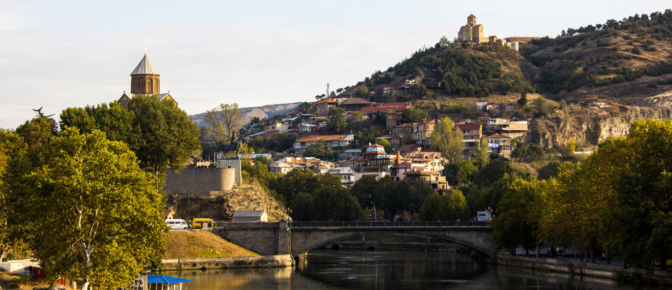
Tbilisi
Georgie waar veel te ontdekken is, deel 1
Georgië, waar nog heel veel te ontdekken is ook voor sportieve mensen.
Naar aanleiding van mijn laatst gehouden seminar toerisme in Georgië en de contacten die ik met het Georgische Verkeersbureau in Tbilisi www.georgia.travel heb, kreeg ik van hen meerdere Engelstalige informatie over diverse onderwerpen.
Hierbij enige korte informatie over wat er te ontdekken, genieten is in Georgië, waar de toerist gezien wordt als een gast gezonden door GOD.
P.S.: de officiele teksten zijn langer en bij het verkeersbureau in Georgie op te vragen.
Brief History : Origin of the name , etc.
Climate : Georgia’s climate is warm and pleasant and Mediterranean-like on the Black Sea coast. The warm climate of Georgia is determined in big part by the mountains of the Greater Caucasus, which keep cold northern winds away from Georgia. Winters are short and mild, and also high mountain regions offer a lot of sun, etc.
Culture / culture : Churches - Archeology - Music - Opera - Dance - Ballet - Art - Theatre, etc.
Flora and fauna: The country has between 4000 and 4500 species of vascular plants, etc
Geography : Georgia, one of the most ancient countries in the world, is located in the region known as the Caucasus or Caucasia, at the cross of Europe and Asia. Georgia is a small country of approximately 69,875 square kilometres — about the size of West Virginia or Switzerland. To the north and northeast, Unable to get map center coordinates, please verify your location! (42, 43.5), etc.
Kazbegi National Park : Kazbegi National Park is located in the historical gorge on the northern slopes of the Caucasus range. The territory of Kazbegi Protected Areas is fragmented, with a total area of 8707 hectares. All of the Kazbegi National Park is mountainous. Its lowest part is located at 1400 m above sea level, etc.
Algeti National Park :The Algeti National Park is located in historical Kvemo Kartli region, in the district of Tetritskaro, at distance of 60 km from Tbilisi city. It covers the southern slopes of eastern part of the Trialeti range in the gorge of the Algeti River and is situated within 1100 – 1950 m above sea level. The highest point is Kldekari (2000 m), etc.
Borjomi-Kharagauli National Park :The Borjomi-Kharagauli National Park is the first National Park in Caucasus that corresponds to the international standards. It was established in 1995 and was officially opened in 2001. According to the area it is one of the best Protected Areas of Europe. In 2007 the Borjomi-Kharagauli National Park became a member of European network of Protected Areas – Pan Park that is a guarantee for highest level protection of these Protected Areas and sustainable development of tourism, etc
Kobuleti Protected Area : The Kobuleti Protected Areas were established in 1999 and cover the Kobuleti Strict Nature Reserve (331 ha) and Kobuleti Managed Nature Reserve (439 hectare), which are located in Achara Autonomous Republic along the Black Sea coast in the northern part of Kobuleti, etc.
Kolkheti National Park : National Park is located in western Georgia. It covers the eastern zone of the Black Sea coast and the basin of the PaliastomiLake. The Park is established with the purpose of protection and surviving of wetland ecosystems, etc.
Lagodekhi Protected Areas are located in the most north eastern part of Georgia, in the Lagodekhi District. This includes the Lagodekhi Strict Nature Reserve and Lagodekhi Managed Nature Reserve along the southern slopes of the main range of the Great Caucasus. The height of the Protected Areas varies within 400-3500 m above the sea level, etc.
Mtirala National Park is located in historical Achara. The territory of Mtirala is constructed by volcanic-sedimentary rocks of so-called “Naghvarevi Pack”, which are presented by alternation of sub-alkali and lime alkali basalts, trachiandesites, andesites, delenites, tuffites, marls and argillites. Mount Mtirala is located between the Black Sea and Achara mountain system on the watershed of Chakvistskali and Koraghitskali.These mountains intercept the humid air from the Black Sea and determine Achara's very humid climate. Generally, Achara is rich in atmospheric precipitation but the Mount Mtirala, height of which is 1381 m above sea level, is the most abundant with precipitation. Annual precipitation reaches to 4520 mm here, due to which the Mount Mtirala is considered as one of the wettest sites not only in Achara but in our country as well.The toponym "Mtirala" (“Weeping”) was given to this Mount just because of abundant precipitation.
Tbilisi National Park was established on the basis of Saguramo Strict Nature Reserve, which was created in 1957. The Park is located at a distance of 25 km from Tbilisi and is included in the Green Zone of the city. The Saguramo Strict Nature Reserve was established with the purpose of maintenance of the forest characteristic for Georgia and protection of the forest habitants, among them the rare species such as Caucasian Red deer and lynx., etc.
Tusheti Protected Area one of the most beautiful regions of Georgia, is located in the eastern Caucasus. Tusheti is bordered by Dagestan to the east and by Chechnya – to the north. Khevsureti is located to the west of Tusheti and Kakheti – to the south. Tusheti, surrounded by the high mountain ranges and summits, is rugged by the numerous gorges, the waters from which flow into the two major rivers of Tusheti – Pirikiti’s Alazani and Tusheti’s (Gometsari) Alazani separated with the watershed of Makratela, etc
